The Clarke Belt in the Ku-Band – A Stroll with the Radio Telescope
A few weeks ago we carried out a fascinating observation with our 1-metre radio telescope: we scanned the so-called Clarke Belt — that is, the celestial equator populated by geostationary satellites — at a frequency of 11.3 GHz in the Ku-band. To do this we used the motor drive of our AVX mount and swept the sky a total of twelve times from east to west, each pass at a slightly different elevation — directly along the equator, and also a few degrees above and below it.
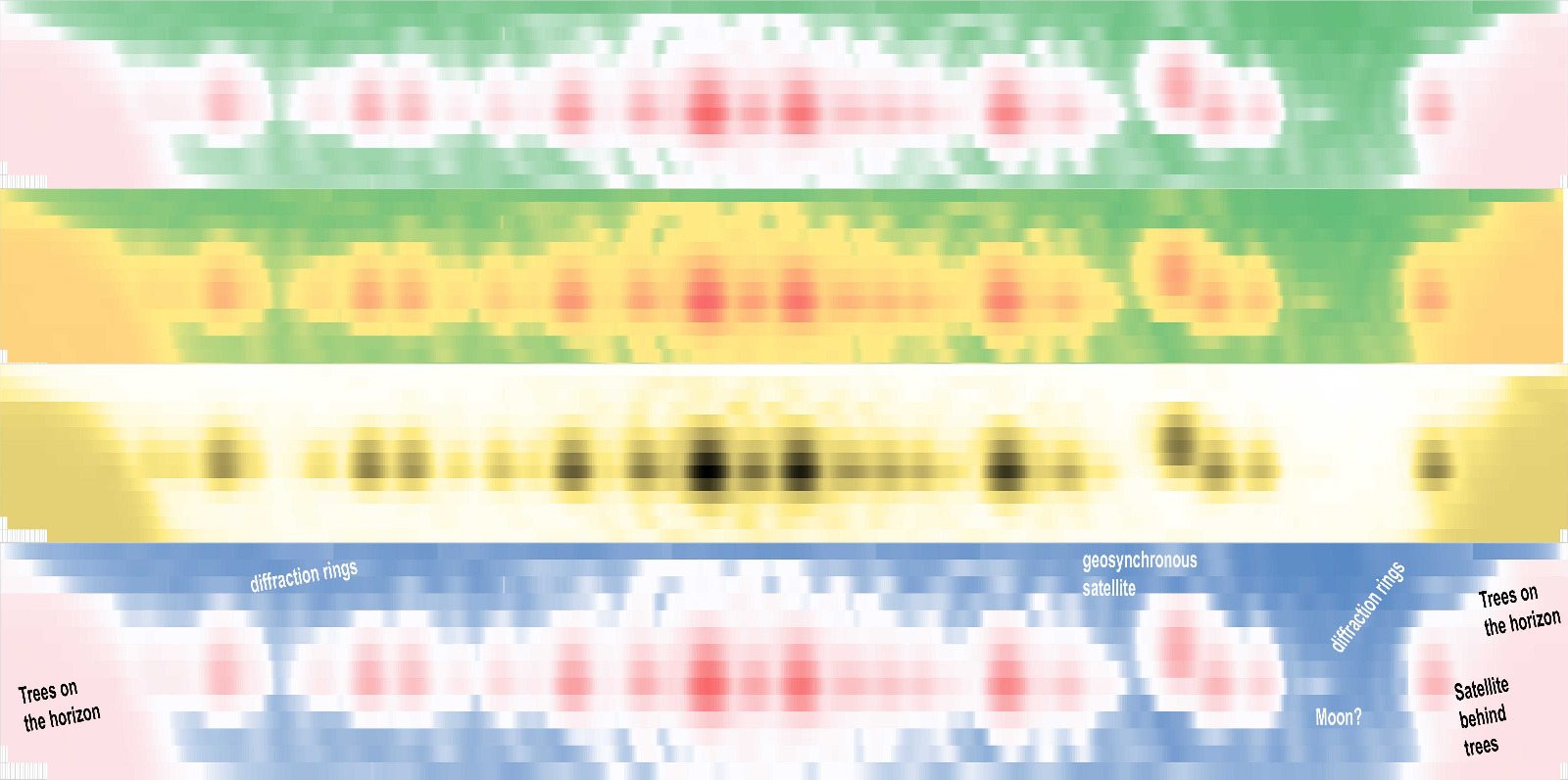
The receiver was once again our tried-and-tested broadband detector based on the AD8362, which we introduced in our previous article. The recorded data were logged with RadioSkyPipe, then transferred scan by scan into Excel and converted into a composite image using the Conditional Formatting function.
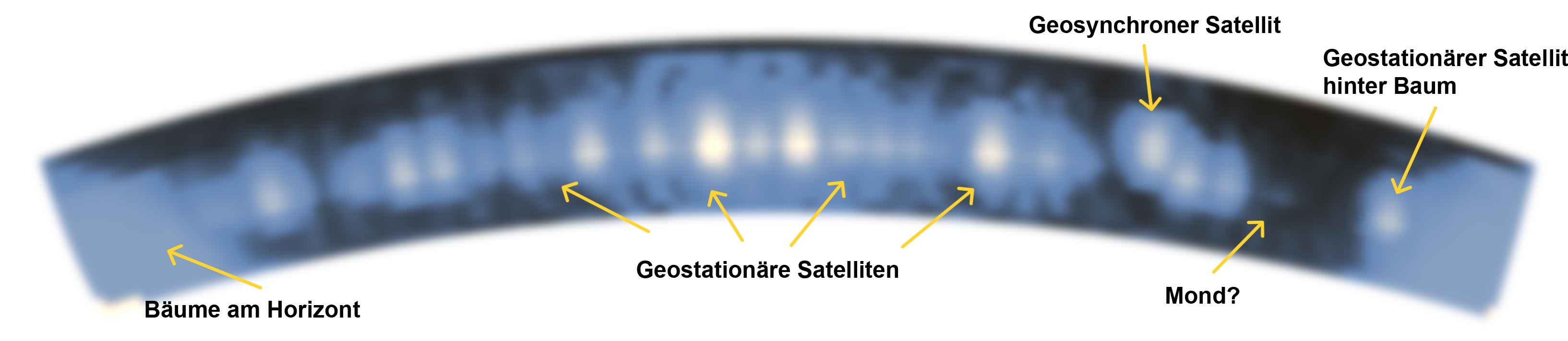
The geostationary satellites are clearly visible, lined up like beads on a string along the celestial equator. We can also identify at least one geosynchronous satellite — unlike their geostationary counterparts, these maintain a fixed compass direction but regularly change their elevation. They appear to drift up and down along the equator, which is also visible in our images.
But it is not only satellites that can be seen: the trees on the horizon leave a clear signature in the radio image, as do the diffraction rings typical of radio telescopes — a phenomenon most of us are more familiar with from optics. And then there is a curious, rather inconspicuous feature just below the Clarke Belt. We cannot say for certain, but on that day the Moon was unusually close to the celestial equator — could it be the culprit?
We are particularly pleased that this time we not only obtained interesting measurement data but also managed to produce an aesthetically appealing image. We present the results of our observation in several false-colour renderings — so that no one can ever again claim that radio astronomers are incapable of producing beautiful pictures.
Incidentally, the Clarke Belt takes its name in honour of the British science-fiction author and visionary Arthur C. Clarke. As early as 1945 he published an article describing the idea of placing communication satellites in an orbit above the equator — at precisely the altitude at which their orbital velocity synchronises with Earth’s rotation. This geostationary orbit lies at approximately 35,786 kilometres above the equator. Satellites in this orbit appear stationary when viewed from Earth — ideal for permanent communication links. Clarke’s vision became reality and today forms the backbone of global satellite communications. In his honour, this special zone in the sky was later named the Clarke Belt.